

Nephin [Neifinn]
Good walks are even better shared.
G1008 : The northern spur from Nephin summit
Colin Park Photo source
Overview
Nephin is an isolated 806 m mountain west of Lough Conn in County Mayo, near Lahardane. Its quartzite slopes, rocky northern corrie and wide summit views make it a distinctive mountain walk. The northern trail and the Pruglish approach both require fitness and navigation skills.
Nephin / Néifinn
Nephin is an isolated 806 m mountain west of Lough Conn in County Mayo, rising above the countryside near Lahardane. Its broad upper slopes and rocky northern corrie give it a distinctive outline. It is a separate mountain from Nephin Beg and the Wild Nephin National Park walking area farther west.
Northern trail from Nephin car park
The promoted northern approach starts at Nephin car park, reached from Lahardane. Follow the forestry tracks and hillside path onto the shoulder beside the northern corrie, then climb towards the summit. Return by the same shoulder, hillside path and forestry approach to the original car park.
The ground becomes rougher above the trees, with wet peat, steep rocky sections, scree and boulders. Waymarks can be sparse higher up, and cloud can make route-finding difficult. Carry a map and compass and be able to use them; the marked approach does not remove the need for mountain navigation. Retracing the ascent avoids committing to an unfamiliar descent across the corrie.
Pruglish south-west approach
A separate approach begins at the forest entrance at Pruglish, Irish Grid G084047, off the R312. Brian Hoban’s published guide describes a complete return walk of approximately 10 km, taking about 4 hours. Follow the forest road past the house, continue along the forest boundary and pass beneath the electricity line. Heather-covered slopes, outcrops and loose stony ground lead to the broad summit crest. Return by retracing the whole ascent to Pruglish.
Summit and views
The summit reference is G103079. The actual high ground lies within 2 m of the trig point, which stands in a depression. Lough Conn lies to the east, with the surrounding Mayo countryside and the Nephin Beg mountains in the wider panorama. Clear conditions are needed for the more distant views.
Terrain and safety
Both approaches are strenuous mountain walks. Expect boggy ground, loose stones and exposed upper slopes. Keep away from the steep edges of the northern corrie, particularly in poor visibility. Rain makes peat and rocky surfaces slippery; strong wind and cloud can increase the difficulty at any season. In winter, short daylight and possible snow or ice require appropriate planning, equipment and experience. Check the forecast and local signs, allow time for the descent and carry food, water and warm waterproof clothing.
Getting there
Lahardane is the nearest village for the northern approach; Crossmolina is another nearby base. Use Nephin car park for the promoted northern trail. The Pruglish forest entrance is the alternative southern starting point. Keep gates, entrances and working forestry access clear, and follow current local restrictions.
TFI Local Link route 454 connects Ballina and Castlebar through Lahardane. Check the operator’s timetable and plan the onward connection from the village to the mountain start, as well as the return journey. Crossmolina Tourist Office can advise on local guides and route choices. Carry the food and drinking water needed for the walk.
Geology and name
Nephin is formed of quartzite. Research by Ballantyne, Stone and McCarroll describes frost-weathered quartzite debris moving downslope and obscuring the upper limit of glacial evidence on the mountain.
The Irish form is Néifinn. Paul Tempan records the name Nemthenn in Cath Maige Tuired, where it is listed among Ireland’s twelve great mountains. The name’s origin is uncertain; a connection with a sanctuary is a possible interpretation, not a settled translation.
Other hills in the area
Tristia (323.1 m), Birreencorragh (698 m) and Croaghmoyle (430 m) are other hills in this part of Mayo. Each requires its own access and route planning.
Explore routes near Nephin [Neifinn]
Walks starting near this hill. Open a route to check its map, distance and full itinerary.
Route planning notes
These notes describe possible approaches. Check a route's map and access information when planning your walk.
Northern trail from Nephin car park and return
Start and finish at Nephin car park on the northern side of the mountain, approached from Lahardane. Follow the promoted trail through the forestry and onto the open hillside, then climb the shoulder beside the northern corrie to the summit. Return down the same shoulder and hillside path, then retrace the forestry tracks to the car park. Expect wet peat, steep rocky sections, loose scree and boulders. Upper waymarks can be sparse, so carry a map and compass and be able to navigate in cloud. Follow current signs and keep forestry access clear.
Pruglish south-west approach and return
Start and finish at the forest entrance at Pruglish, Irish Grid G084047, off the R312. Follow the forest road past the house, continue beside the forest boundary and pass beneath the electricity line. Climb the heather-covered slopes and rocky ground towards the broad stony summit crest. The high point is within 2 m of the trig, which stands in a depression. Retrace the entire ascent to Pruglish. Brian Hoban’s published guide gives approximately 10 km and about 4 hours for the complete return walk. Keep the entrance clear and obey local forestry and access signs.
Make a day of it, together
Find someone to share the walk with, or organise a day out along a route you like.
Photo Gallery
View all Photo could not load
G1008 : The northern spur from Nephin summit
Colin Park
 Photo could not load
G1008 : Nephin Mountain from Lough Conn
Tony Steed
 Photo could not load
G1007 : Approaching the top of Nephin from the SW
Colin Park
Hill facts and local notes
Classifications
Elevation
806m
2,644 ft
Prominence
768m
Coordinates
54.0133, -9.3684
G103079
OS Map
23 31
At the Summit
The summit is at G103079, with the highest ground within 2 m of the trig point. The trig itself stands in a depression.
Terrain & Geology
Nephin is formed of quartzite. Ballantyne, Stone and McCarroll’s study of western Ireland describes downslope movement of frost-weathered quartzite debris on Nephin, obscuring the upper limit of glacial evidence.
Views & Scenery
Lough Conn lies east of the summit, with wide views over the Mayo countryside and towards the Nephin Beg mountains in clear weather.
History & Heritage
Name Origin
Néifinn is the Irish form. Its origin is uncertain; Paul Tempan suggests a possible connection with a sanctuary. The interpretation is not definitive.
Historical Significance
Paul Tempan records Nephin as Nemthenn in Cath Maige Tuired, where it is listed among Ireland’s twelve great mountains. Its name has an uncertain origin; a possible connection with a sanctuary remains an interpretation rather than an established tradition.
Getting There & Facilities
Parking
Use Nephin car park on the northern side of the mountain, approached from Lahardane, for the promoted trail. The alternative Pruglish approach starts at the forest entrance at G084047 off the R312. Follow local signs and keep gates and forestry entrances clear.
Public Transport
TFI Local Link route 454 connects Ballina and Castlebar through Lahardane. Check the current operator timetable and plan the onward connection from the village to the mountain start and the return journey: https://cordufftravel.ie/time-tables/route-454/
Nearby Facilities
Carry food, drinking water and warm waterproof clothing for the mountain. Crossmolina Tourist Office can advise on local guides and routes.
Safety Information
Known Hazards
- Wet peat and boggy ground, especially after rain
- Steep rocky slopes, loose scree and boulders
- Steep edges around the northern corrie
- Sparse upper waymarks and difficult navigation in cloud
- Exposed upper slopes, strong winds and rapid weather changes
Seasonal Hazards
Rain makes peat and rocky surfaces slippery. Strong winds and cloud can make the exposed upper slopes difficult at any season. Winter brings short daylight and possible snow or ice; plan the descent and carry equipment suited to the conditions.
General Safety Tips
- Check weather conditions before setting out
- Carry appropriate clothing and equipment
- Let someone know your planned route
- Take a map, compass, and GPS device
- Carry emergency supplies: food, water, first aid kit, torch
Hills
Some common questions about the hills answered
Are there group walks up Nephin [Neifinn]?
Many walkers use Walkmates to join or organise walks with others. You can check for group walks around Nephin [Neifinn] through the maps
Are there other walkers around Nephin [Neifinn]?
Activity varies by location and time, but Walkmates lets you see whether others have shared walks or shown interest in this area. Find other people through the walking friends search walking friends for Nephin [Neifinn] search or of course create your own walk for Nephin [Neifinn]
Can I organise a walk to Nephin [Neifinn]?
Yes. If there aren’t any walks listed already, you can create a walk and make it available for others to join.
If you're signed up to Walkmates, you can create a walk to Nephin [Neifinn].
How do I find a walk up this hill?
There are often multiple ways to walk this hill, depending on experience and route preference. Walkmates helps you explore walks and routes that others have shared.
Can I suggest a new route up Nephin [Neifinn]?
Yes. You can suggest or create routes to share with others. Walkmates focuses on the social side of walking, so routes are used to help people organise walks and explore areas together, rather than as detailed navigation tools or route libraries.
Other uses really appreciate knowledgeable walkers sharing their routes. Share your favourite route to Nephin [Neifinn] here
The is an error or something incorrect about this hill. How do I let you know?
We always strive to keep the information on Walkmates as accurate as possible. If you find an error, please let us know through the contact form and we'll aim to correct it as quickly as possible
Community Discussion
Comments
Location
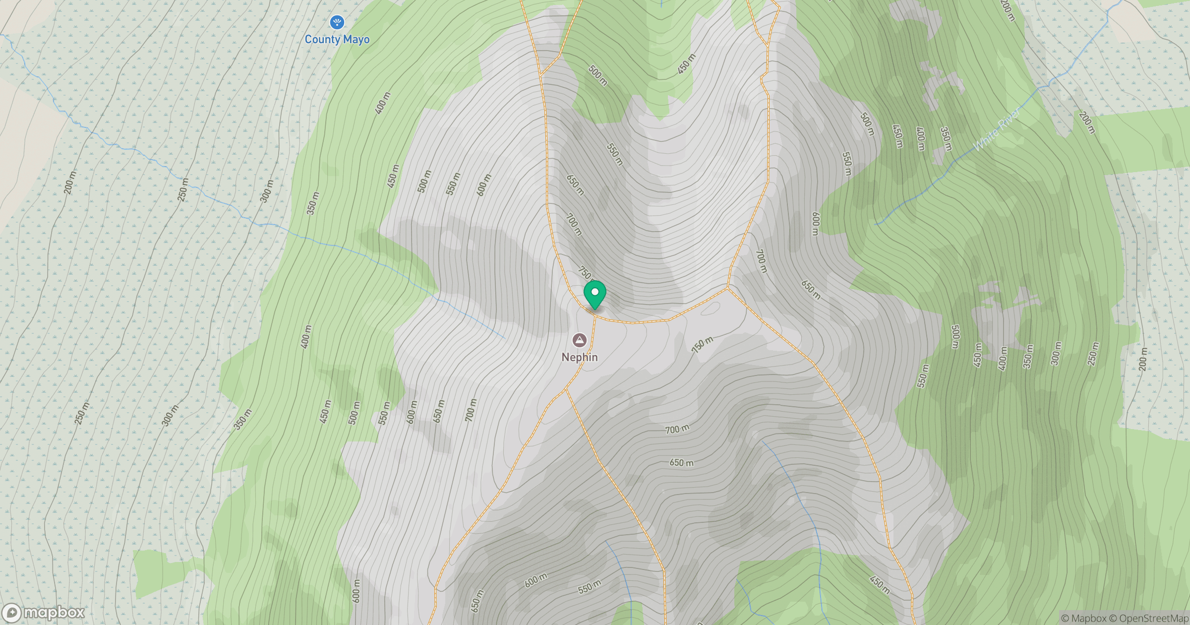
Grid reference: G103079
View on OpenStreetMapOpens a map in a new tab, centred on the hill.
No comments yet. Be the first.